


Description
Pedro de Teixeira Albernas, Portuguese cartographer at the service of the King of Spain, who lived between the end of the 16th century and 1662, arrives at the circle of cosmographers of the court of Felipe IV by the hand of his compatriot Juan Bautista de Labaña, participating from that moment in various cartographic companies of which hardly remain trace, for having remained his manuscript results and in ignored whereabouts until today.
This is the case of this edition in facsimile, the cartography of the coasts of Spain raised, by royal order, from 1622, which was believed lost, and which is partly found in this rich manuscript of the Carolina Library of the University of Uppsala (Sweden) since 1824.
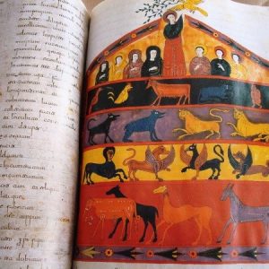
The “Compendium Geographicum”, dated around 1660, seems to be, honoring its title, a brief and summary written exhibition on the geographical knowledge of the time, accompanied by richly illuminated maps and a synthesis of all the cartographic work of Pedro Teixeira at different scales, the result of companies that consumed a good part of their existence. Cartography that, as far as the Peninsula is concerned, is the result of a meticulous and extensive fieldwork, of which there is documentary evidence; what comes to amend the emptiness attributed until today to the peninsular cartographic production of the XVII century.
The map of the Peninsula may well be the graphic result of the work of the Commission of the Map of Spain presided over in the 1620s by Labaña, in which Teixeira was integrated newly arrived in Madrid claimed by his teacher and mentor; and in which, by force, at the death of Labaña in 1624, he had to acquire an obligatory role.
The maps of the coasts of Spain, as it is demonstrated, are the result of the commission entrusted by the crown in 1622, and reflect, like the text, the detailed knowledge of the peninsular territory that Teixeira had.
Finally, his map of the world, his Theatrum Orbis Terrarum, more than highlighting the knowledge of the materials published in his time, may also reflect his own youth traveling experience, as he had participated in an expedition to recognize the Straits of Magellan and San Vicente in the years 1618 and 1619, and consequently had direct information from the New World.
Facsimile:
Author: Pedro de Teixeira (or Texeira) (late 16th-16th century)
Work: Compendium Geographicum (1660)
Manuscript guarded in the Library of the Swedish University of Uppsala
It contains 8 double-page maps, including a world map and a map of Spain, and 11 capitulars adorned with gold.
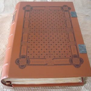
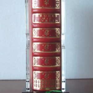
Printed in 7 colors, in stochastic screen; hand sewn, aged and bound in parchment, with gold edges and inlays in gold in lids and two loops of leather ribbon. The maps are sewn in cartivana so there is no loss in the fold of the page.
98 pages.
Format 12.5 x 17.3 cm.
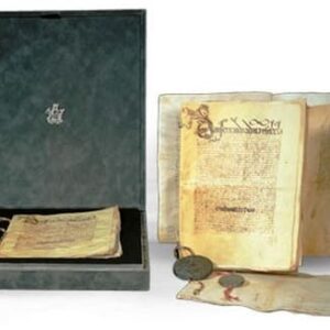
Limited circulation and authenticated with notarial deed to 999 copies.
Study book:
This volume, complementary to the facsimile edition, contains an extensive study of the work and its author, carried out by Mr. Ramón Alvargonzález Rodríguez, Professor at the University of Oviedo, and prefaced by Mr. Ulf Göranson, Director of the University Library of Uppsala.
Bound in hardcover lined in blue fabric with gold letters. Format 17,3 x 25,1, 144 pages. Bilingual Spanish and English, with the commentary and transcription of the original text.
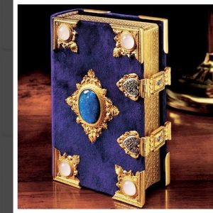
It is presented in a beautiful blue box with golden letters, format 23 x 30 x 5 cm, containing the facsimile, the notarial deed and the study book. Total weight: 1.476 gr.
This edition is complementary to the extraordinary facsimile of the Atlas of Pedro Texeira of 1634 that Siloé published in 2004, whose original is in the National Library of Austria, and which we also have available here.
Exemplary in perfect condition.
Download the attached pdf file for more information. Texts in Spanish and English.
Shipping costs on account of the buyer, according to order and destination. Consult us without obligation (indicating the reference of the article) any doubt.